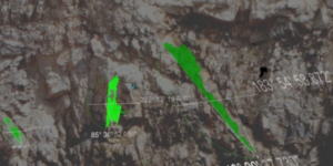
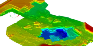
UAV Post Processing Video Example

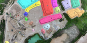
An example of Pix4D photogrammetry processing. Starting the process from receiving the images from the client we will render and check the data for consistency and issue the reports and deliverables as required by the client.

Professional LiDAR Scanning

Professional LiDAR Scanning

The ability to use various LiDAR and UAV technologies in the field allows us to rapidly capture data in adverse conditions while maintaining timelines for quarry updates or stockpile inventories.

UAV / Drone Platforms

UAV / Drone Platforms

Various types of UAV / Drone systems that can be equipped with photogrammetry or LiDAR are available for a variety of projects. We understand the strengths and weaknesses of each platform and technology, so we can use the right tool for each job we do.

Stockpile Inventories

Stockpile Inventories

Inventory is the core of our department and continues to be updated and refined as technology advances. We complete stockpile inventories for various clients with different needs from UAV only, none flight zones, sheds, and underground inventory.

Geotechnical Data Capture

Geotechnical Data Capture

High resolution georeferenced data can be captured and processed ready to import into various geotechnical software packages.

Quarry & Open Pit Mapping

Quarry & Open Pit Mapping

LiDAR and/or photogrammetry point clouds of open pit mines is used to generate a surface, contours, quarry updates, and as built vs. design comparisons.

Introducing WingScan-B

The premier maintenance-free solution that delivers real-time volume and mass flows on each conveyor belt. Connect, monitor and command each system via secure and intuitive controls on mobile or desktop, or easily connect to a variety of PLC systems.