Case Studies
Overburden / Stripping Example
An overlay of the point clouds captured from a LiDAR UAV / Drone is made into strips and overlaid on the final rendered surface. Being able to determine ground surface from the tops of trees and vegetation is critical for volume calculations.
Dome Inventory Example
Stockpile inventory example in a dome. Data is captured in minutes and can give visual insights and measurements of the current dome or silo stockpile.

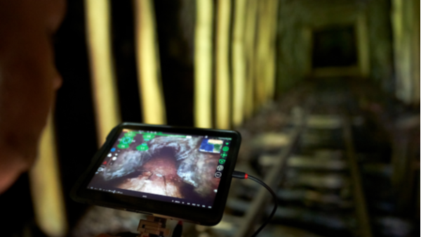
Room and Pillar Scanning
Using static and dynamic LiDAR systems we are able to map, measure, and track room and pillar progress. LiDAR and processing data allows for enhanced visualization of areas of interest and more precise volumetrics.
Stockpile Surface Example
A stockpile yard at a port scanned and processed, the rendered surfaces ready for volumetric modeling. Point cloud data can be created from UAV / Drone and combined with LiDAR data.
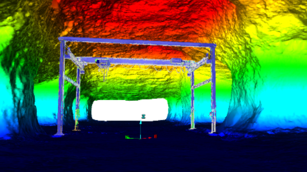
Mine Shaft Scanning
Shaft scanning has been used for rehab, repairs, change detection, and historical mapping. The ability to mount our dynamic LiDAR system to a cage and map shafts effectively, safely, and quickly means lower amounts of downtime in hoist operations.
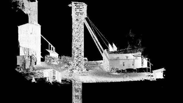
Underground Structure Scanning
With the ability to scan and map with high resolution gives Wingfield expertise in structure scanning not only on the surface but underground. Making upgrades to structures or creating blueprints that can be accessed anywhere saves time and money.
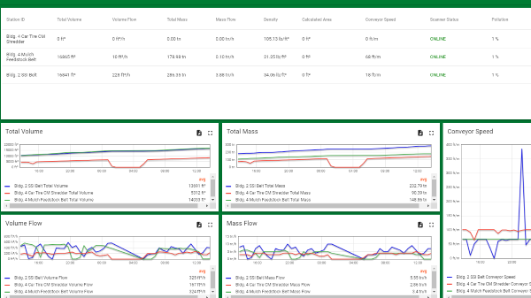
WingScan-B Web Portal Monitoring
Monitor your production from anywhere using the WingScan-B Web Portal. Every belt at every site, with customizable graphs and reporting capabilities.
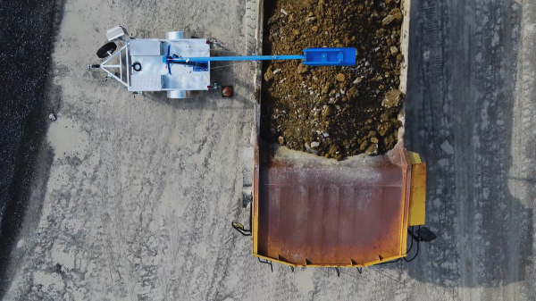
Ideal for Overburden Stripping Operations
Create verified reports that both contractor and site can agree upon. Track project progress, efficiencies, truck route timing, and more!
Autonomous UAV LiDAR Scanning
This UAV can be manually or autonomously flown to map areas that are inaccessible or lack the structural integrity for safe entry. It is commonly used for stopes and voids, failing and older or abandoned working areas, and for basic inspection.
Interested in learning how Wingfield can help your business?
Schedule a conversation with a wingfield specialist!
or call 423-698-0100