
Surface and Quarry
Stockpiles, bulk material inventory, and quarries are measured through the latest technology available. Emphasizing our clients needs of high accuracy data with fast turnaround is a core principle of our department.
Related Case Studies

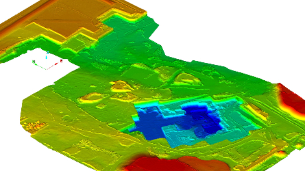
Overburden & Stripping Surveys
Visually and quantitively verify contractors reports for overburden removal. Once approved the overall quarry surface can be updated reflecting the new changes.
Change Detection Scanning
Create customized data ranges to determine the distance of change and visualize the variance. This can be useful for overburden, reclamation, shotcrete depths, or tracking movement of material.

Clearance Checks Examples
Bringing in new equipment or moving a large piece through a facility. We can help with clearance checks by scanning the structures in the surrounding areas. Data can later be used for additional checks and reference for other projects.

UAV / Drone Specific Work (LiDAR & Photogrammetry)
Ensuring large projects such as stripping/overburden projects are captured accurately is extremely important. With access to LiDAR & photogrammetry platforms and post processing abilities for both Wingfield can custom tailor the data capture.

UAV/Drone Photogrammetry Post Processing & Upload Service
Using a UAV/Drone but don’t have the time to complete post processing? Upload your images and ground control points to Wingfield. We will recommend best practices, validate the uploaded data, and and and ensure post processing is completed accurately.

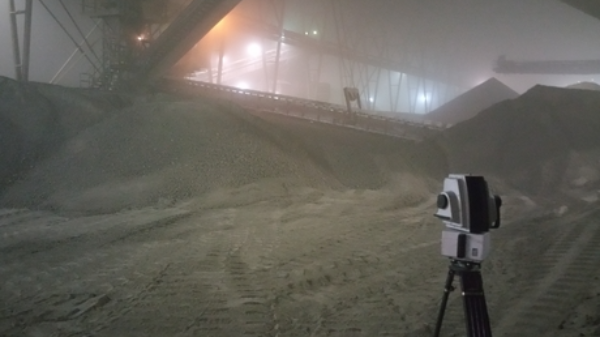
Professional LiDAR Scanning
The ability to use various LiDAR and UAV technologies in the field allows us to rapidly capture data in adverse conditions while maintaining timelines for quarry updates or stockpile inventories.

UAV / Drone Platforms
Various types of UAV / Drone systems that can be equipped with photogrammetry or LiDAR are available for a variety of projects. We understand the strengths and weaknesses of each platform and technology, so we can use the right tool for each job we do.
Shed & Barn Stockpile Inventories
Repeatable and high accuracy data is required for scanning inside sheds and stockpiles. With normally less than ideal environments, we are experienced with capturing and rendering consistent results safely.
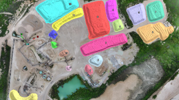
Stockpile Inventories
Inventory is the core of our department and continues to be updated and refined as technology advances. We complete stockpile inventories for various clients with different needs from UAV only, none flight zones, sheds, and underground inventory.

Geotechnical Data Capture
High resolution georeferenced data can be captured and processed ready to import into various geotechnical software packages.
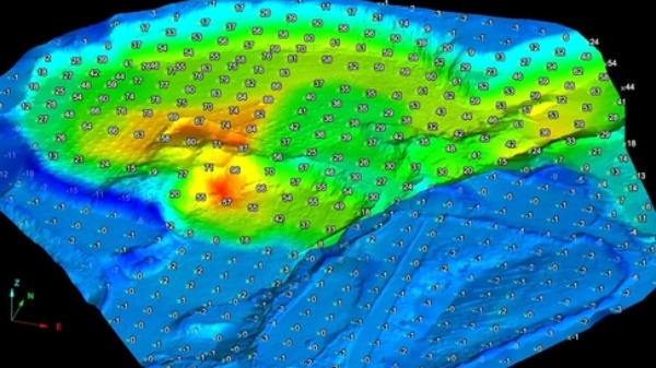
Quarry & Open Pit Mapping
LiDAR and/or photogrammetry point clouds of open pit mines is used to generate a surface, contours, quarry updates, and as built vs. design comparisons.
Interested in learning how Wingfield can help your business?
Schedule a conversation with a Wingfield specialist!
or call 423-698-0100
Wingfield helped us overcome some problems and obstacles we had and didn’t flinch. It’s refreshing to see someone take that on. They see the bigger picture.