Quarry & Open Pit Mapping
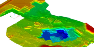
LiDAR and/or photogrammetry point clouds of open pit mines is used to generate a surface, contours, quarry updates, and as built vs. design comparisons.
LiDAR and/or photogrammetry point clouds of open pit mines is used to generate a surface, contours, quarry updates, and as built vs. design comparisons.