
Case Studies
Factories and Forges
Factories built years ago have undergone many changes and upgrades, documenting these changes, and checking clearances for new equipment can save time and money by having a digital model to reference and measure.

UAV / Drone Specific Work (LiDAR & Photogrammetry)
Ensuring large projects such as stripping/overburden projects are captured accurately is extremely important. With access to LiDAR & photogrammetry platforms and post processing abilities for both Wingfield can custom tailor the data capture.

UAV/Drone Photogrammetry Post Processing & Upload Service
Using a UAV/Drone but don’t have the time to complete post processing? Upload your images and ground control points to Wingfield. We will recommend best practices, validate the uploaded data, and and and ensure post processing is completed accurately.
UAV Post Processing Video Example
An example of Pix4D photogrammetry processing. Starting the process from receiving the images from the client we will render and check the data for consistency and issue the reports and deliverables as required by the client.

Dome Inventory Volume Cross Section View
A cross sections view of the LiDAR point cloud data gathered in a dome for inventory measurements.

Point Cloud Data of Collapsed Inaccessible Tunnel
This point cloud data was captured using Autonomous UAV LiDAR to be used for rehabilitation project analysis in a partially collapsed rail tunnel.
Custom Bulk Inventory Scale
Improve the speed of product flow and the efficiency of your cycle counts or physical inventory by using our custom bulk inventory scales, which are available in various shapes, sizes and weighing modes.
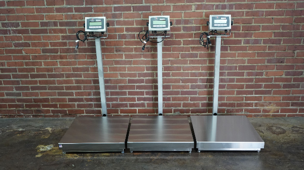
Stainless Steel Platform Scales
We have a variety of stainless steel platform scales that are durable in highly corrosive environments and can be cut, welded and shaped easily.
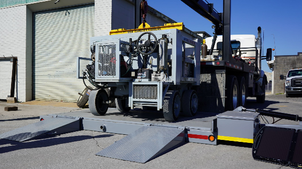
Solar Powered Portable Axle Scale
Available for rent or purchase, our solar powered portable axle scales are heavy duty, easy to use, and can be placed in remote environments where its difficult to get electricity. We also have portable wheel weighers.
Interested in learning how Wingfield can help your business?
Schedule a conversation with a wingfield specialist!
or call 423-698-0100