Case Studies

Assembly
In addition to the quality service we’ve provided our customers for over 85 years, we can work with you to assemble or modify the scale to fit your needs.

Multi-Layer Packout Station
This custom solution checkweighs each layer of the packout process, ensuring that every step of the packout process contains the correct amount of parts.

Custom Scale
Throughout our 85-year history we’ve customized every type of scale on the market. Give us the opportunity to provide a custom solution for you.
Custom Mixing Scales
Our custom mixing scales include an intuitive, functional, user-friendly design for your most material sensitive and complex mixing applications.

Truck Scales with Solar Panels
Need a truck scale in a remote location where it’s difficult to access electricity? Give us a call today about implementing a solar solution with your existing truck scale and its display.
We Make Custom Checkweighers
Our checkweighers can be built with lower and/or upper limits to help you effectively sort, package or properly reject out of tolerance product. We can design a checkweigher to improve the accuracy of your product and shipments.
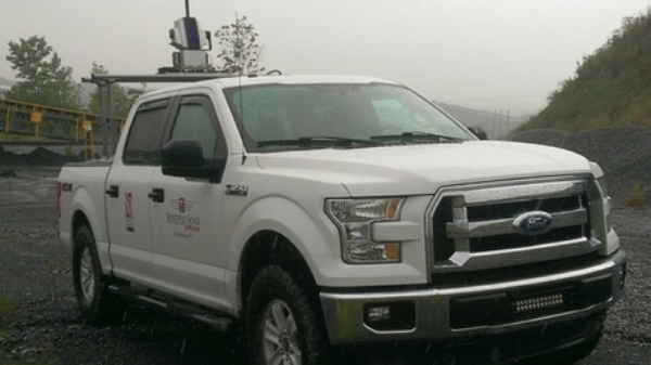
Professional LiDAR Scanning
The ability to use various LiDAR and UAV technologies in the field allows us to rapidly capture data in adverse conditions while maintaining timelines for quarry updates or stockpile inventories.
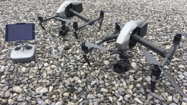
UAV / Drone Platforms
Various types of UAV / Drone systems that can be equipped with photogrammetry or LiDAR are available for a variety of projects. We understand the strengths and weaknesses of each platform and technology, so we can use the right tool for each job we do.
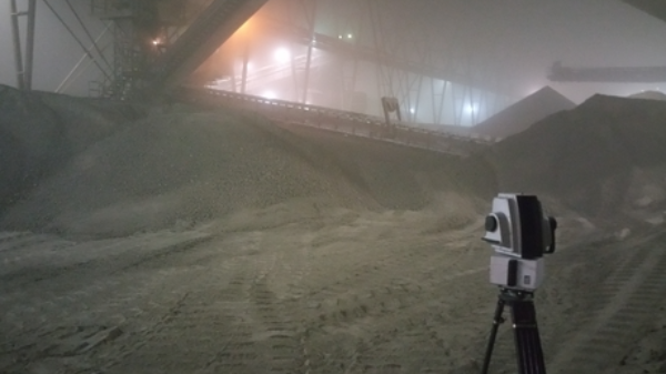
Shed & Barn Stockpile Inventories
Repeatable and high accuracy data is required for scanning inside sheds and stockpiles. With normally less than ideal environments, we are experienced with capturing and rendering consistent results safely.
Interested in learning how Wingfield can help your business?
Schedule a conversation with a wingfield specialist!
or call 423-698-0100