
Underground Mapping
Specializing in underground mapping and shaft scanning for clients in the mining industry Wingfield continues to expand. The most recent additional service to be offered is autonomous UAV / Drone LiDAR Mapping for inaccessible areas.
Related Case Studies

Room and Pillar Scanning
Using static and dynamic LiDAR systems we are able to map, measure, and track room and pillar progress. LiDAR and processing data allows for enhanced visualization of areas of interest and more precise volumetrics.

Mine Shaft Scanning
Shaft scanning has been used for rehab, repairs, change detection, and historical mapping. The ability to mount our dynamic LiDAR system to a cage and map shafts effectively, safely, and quickly means lower amounts of downtime in hoist operations.

Underground Structure Scanning
With the ability to scan and map with high resolution gives Wingfield expertise in structure scanning not only on the surface but underground. Making upgrades to structures or creating blueprints that can be accessed anywhere saves time and money.
Autonomous UAV LiDAR Scanning
This UAV can be manually or autonomously flown to map areas that are inaccessible or lack the structural integrity for safe entry. It is commonly used for stopes and voids, failing and older or abandoned working areas, and for basic inspection.

Headframe Structural Example
If a structure is being rehabbed or being upgraded and there is limited access on a daily basis. Scanning the structure can be valuable for contractors to check measurements without going to site or stopping production.

Underground Crane Example
Planning upgrades for underground but need to be sending information to contractors on placement of equipment or measurements? Digital twins allow you take measurements in software and avoid the cage ride to check on a measurement.

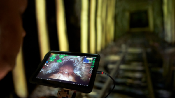
Point Cloud Data of Collapsed Inaccessible Tunnel
This point cloud data was captured using Autonomous UAV LiDAR to be used for rehabilitation project analysis in a partially collapsed rail tunnel.

Professional LiDAR Scanning
The ability to use various LiDAR and UAV technologies in the field allows us to rapidly capture data in adverse conditions while maintaining timelines for quarry updates or stockpile inventories.

Geotechnical Data Capture
High resolution georeferenced data can be captured and processed ready to import into various geotechnical software packages.
Interested in learning how Wingfield can help your business?
Schedule a conversation with a Wingfield specialist!
or call 423-698-0100
Wingfield helped us overcome some problems and obstacles we had and didn’t flinch. It’s refreshing to see someone take that on. They see the bigger picture.