
Stockpile Inventory
Effectively managing your stockpile inventory the right way is important if you want to keep your operations smooth. But let’s face it, accurately measuring those stockpiles can be tough (especially when they’re in sheds, underground, or dangerous areas).
Effortlessly Manage Your Stockpile Inventory with Wingfield’s Advanced Solutions
Did you know? We also specialize in inventory measurements for stockpiles housed inside domes and silos, even in hazardous environments. Learn more about dome Inventory management here.
Let Wingfield Streamline Your Stockpile Measurement Process Today!
Related Case Studies
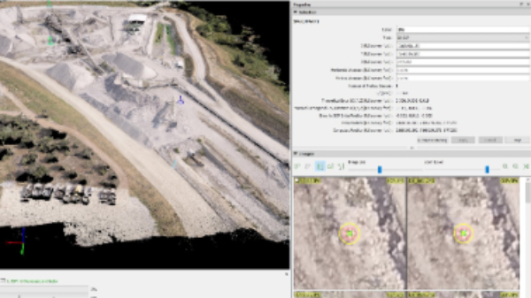
UAV/Drone Photogrammetry Post Processing & Upload Service
Using a UAV/Drone but don’t have the time to complete post processing? Upload your images and ground control points to Wingfield. We will recommend best practices, validate the uploaded data, and and and ensure post processing is completed accurately.
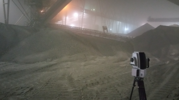
Shed & Barn Stockpile Inventories
Repeatable and high accuracy data is required for scanning inside sheds and stockpiles. With normally less than ideal environments, we are experienced with capturing and rendering consistent results safely.
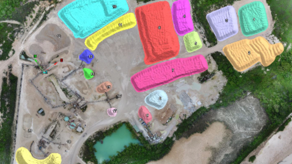
Stockpile Inventories
Inventory is the core of our department and continues to be updated and refined as technology advances. We complete stockpile inventories for various clients with different needs from UAV only, none flight zones, sheds, and underground inventory.
Interested in learning how Wingfield can help your business?
Schedule a conversation with a Wingfield specialist!
or call 423-698-0100
Wingfield helped us overcome some problems and obstacles we had and didn’t flinch. It’s refreshing to see someone take that on. They see the bigger picture.