
Autonomous UAV Mapping
Struggling to capture accurate data in hazardous areas? Wingfield’s Autonomous UAV Mapping can safely get the job done.
Try Our Unique UAV Mapping for Difficult Areas
Learn more about LiDAR technology from the U.S. Geological Survey here.
Trusted By Leading Industries:

Related Case Studies
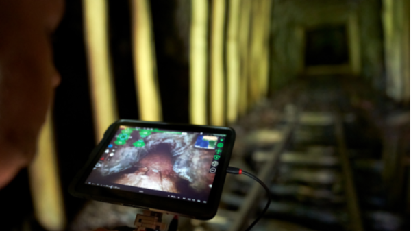
Autonomous UAV LiDAR Scanning
This UAV can be manually or autonomously flown to map areas that are inaccessible or lack the structural integrity for safe entry. It is commonly used for stopes and voids, failing and older or abandoned working areas, and for basic inspection.

Point Cloud Data of Collapsed Inaccessible Tunnel
This point cloud data was captured using Autonomous UAV LiDAR to be used for rehabilitation project analysis in a partially collapsed rail tunnel.
Interested in learning how Wingfield can help your business?
Schedule a conversation with a Wingfield specialist!
or call 423-698-0100
Wingfield helped us overcome some problems and obstacles we had and didn’t flinch. It’s refreshing to see someone take that on. They see the bigger picture.